Pinyon Pine Aerial Survey Datasets
| YEAR |
Shapefile - with previous years impacts |
Shapefile - without previous years impacts |
KML - with previous years impacts |
KML - without previous years impacts |
jpg - with previous years impacts |
jpg - without previous years impacts |
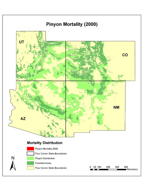
| 2000 |
|
N/A |
|
N/A |
|
N/A |
| 2001 |
|
N/A |
|
N/A |
|
N/A |
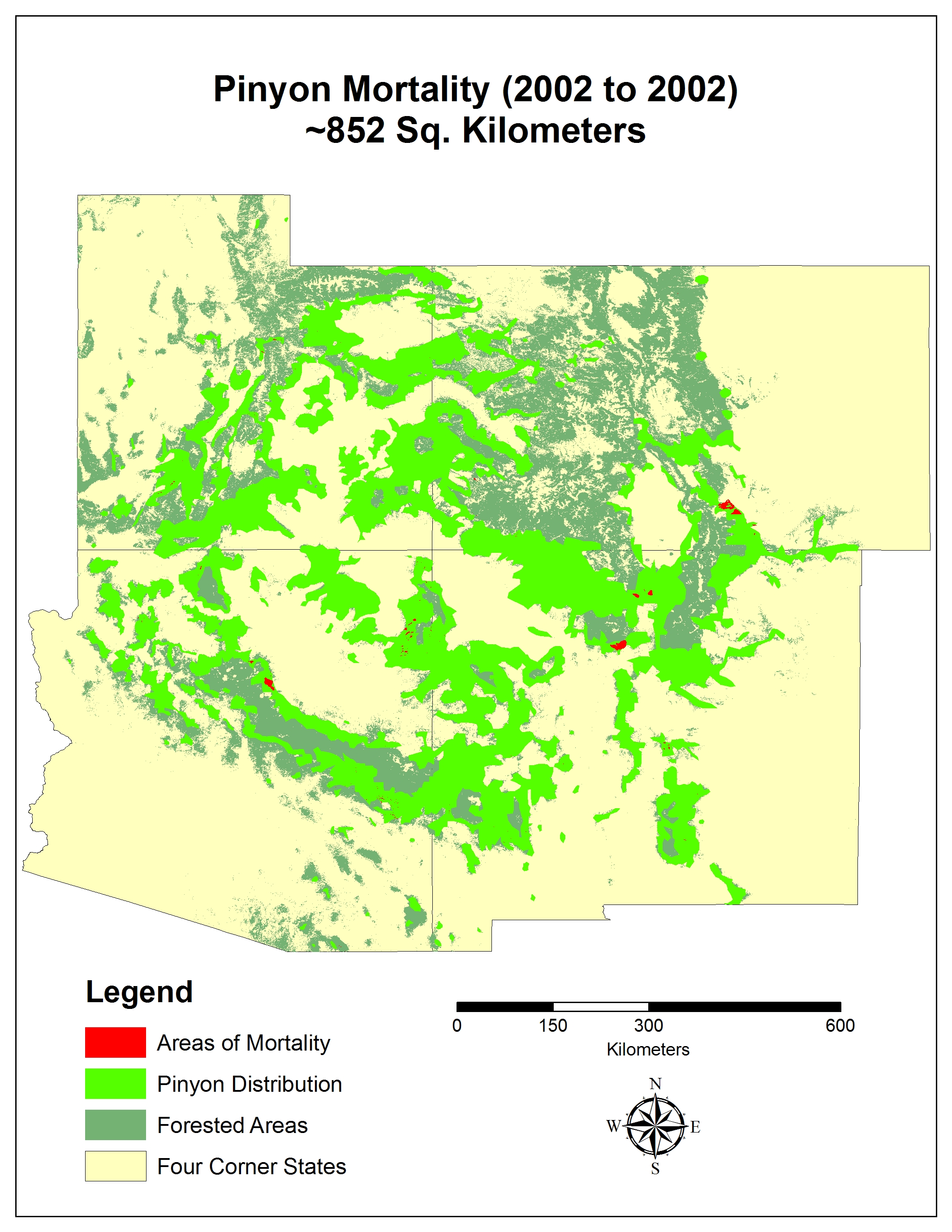
| 2002 |
|
N/A |
|
N/A |
|
N/A |
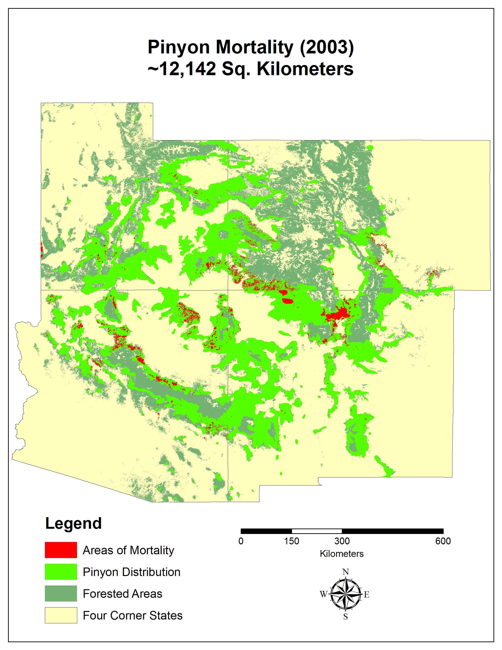
| 2003 |
|
|
|
|
|
|
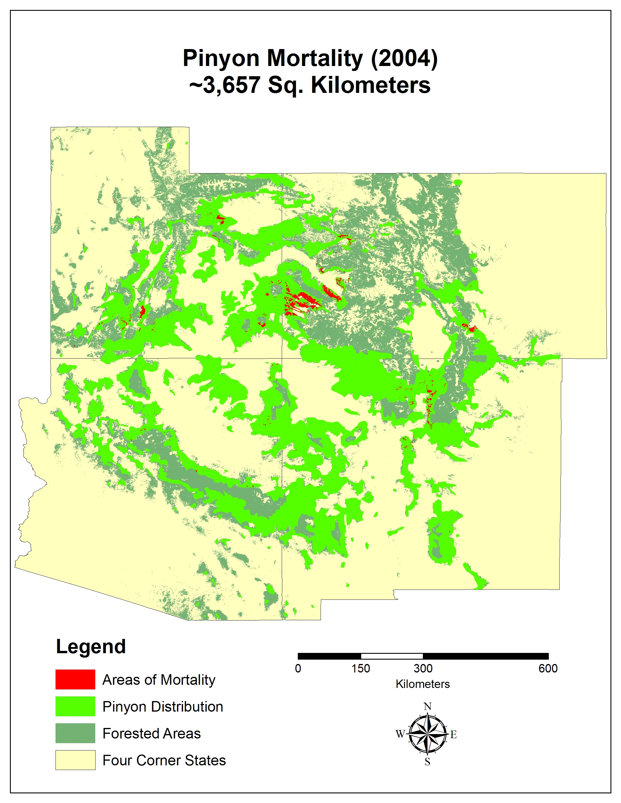
| 2004 |
|
|
|
|
|
|
| 2005 |
|
|
|
|
|
|
| 2006 |
|
|
|
|
|
|
| 2007 |
|
|
|
|
|
|
| 2008 |
|
|
|
|
|
|
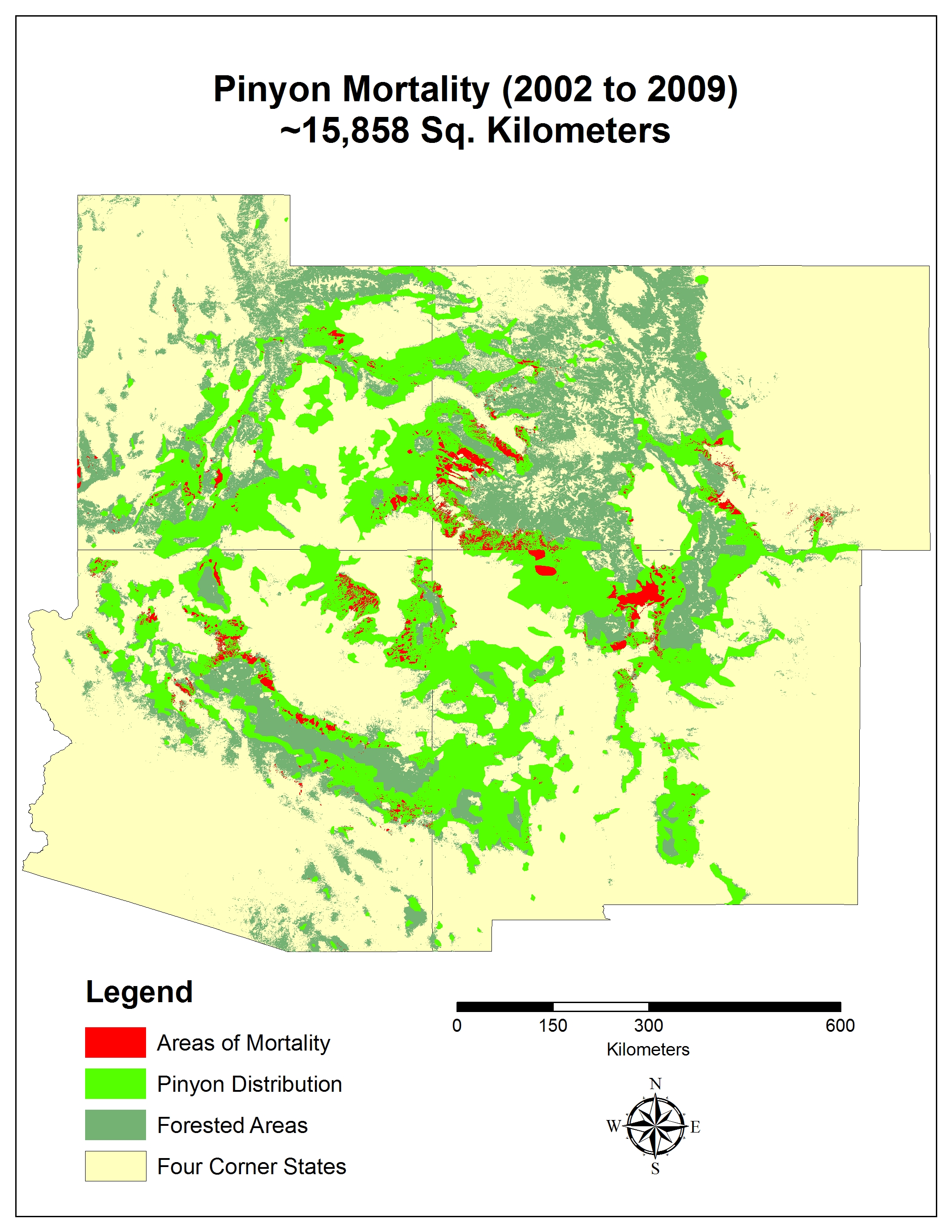
| 2009 |
|
|
|
|
|
|
KML files are intended to be viewed using Google Earth. You need at least version 4.3.7284 to properly view these files.
All shape files are ESRI ArcGIS 9.2 format and all files were zipped using the open source utility 7-zip. The jpg files are intended to be easily imported into documents or powerpoint presentations.
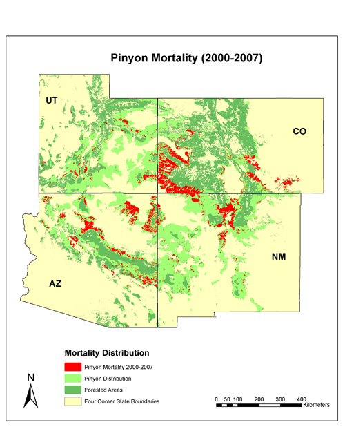
Click on the map below to download a high-resolution version of this map.
|

