
ITEP Resources:
PO Box 15004, Flagstaff, AZ 86011-5004
Fax: (928) 523-1266
itep@nau.edu


Resources
Maps & Data Downloads
US Tribal Point Source Maps:
Mercury Map: Mercury sources and Tribal Lands Map [pdf 2.1mb 17x11]
Mercury Map document: MS Word document which provides some background and purpose of the Mercury Map. [doc]
NOx Map: Nitrogen Oxide (NOx) Emissions Map [pdf 2.4mb 17x11]
PM 10 Map: PM 10 is measure of particles in the atmosphere with a diameter of less than ten or equal to a nominal 10 micrometers. [pdf 1.7mb 17x11]
PM 2.5 Map: PM 2.5 is a measure of smaller particles in the air. [pdf 2.4mb 17x11]
GIS Mapping AirData:
These exercises is designed to provide step-by-step instructions on how to view data on sources of air pollution
available from the U.S. Environmental Protection Agency (EPA) using ArcInfo.
Download: Exercises
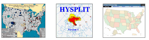
Trajectory Modeling:
A Powerful Tool for Identifying Air Pollution Sources. Glenn Gehring (TAMS Technology Specialist II) has
created an effective step-by-step guide on using the HYSPLIT program to generate a simple backward trajectory
and integrate it into a GIS program. There is also a guide to downloading emission inventory data from
EPA's AirData website and integrating the data into a GIS program.
Plugging-in data and examining pollution sources, prevailing wind direction, meteorological conditions,
backward trajectories and dispersion plumes during poor air quality events can give a tribal air
professional a solid understanding of area sources and pollutants impacting the reservation.
Download: Trajectory Modeling [pdf]
GIS Maps resources:
Goolge Earth:
Google Earth lets you fly anywhere on Earth to view satellite imagery, maps, terrain, 3D buildings and
even explore galaxies in the Sky. You can explore rich geographical content, save your toured places and
share with others.
www.google.com/earth/index.html
OpenLayers WMS:
Google Map and a OpenLayers WMS.
openlayers.org/en/latest/examples/wms-tiled.html
MapTech:
MapTech Mapserver is your online resource for USGS Topo Maps, NOAA Nautical Charts, NAV Photos, and Aeronautical Charts.
www.richardsonscharts.com/
Report Broken Links, Missing Pages, or Accessibility Issues
Report form
For more information please contact:
ITEP Maps
itep@nau.edu